
Underground Utility Locating along the Manistee River
GPRS (Ground Penetrating Radar Systems, Inc.) was hired by a local dredging and marine construction company in March 2020. They planned to dredge roughly 1,300 linear feet of the Manistee River and excavate contaminated soil from roughly 3.5 acres on the shoreline. The role of GPRS was to locate the existing utilities within the proposed excavation areas and determine if any underground utilities were crossing the river from shoreline to shoreline where dredging activities were to occur.
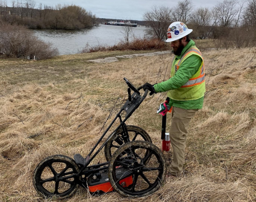
Upon arrival, we performed a site walk along the north and south riverbanks of the proposed dredging area and in the proposed excavation areas. This site walk allowed us to visually observe any surface features indicating existing utilities in the area (manholes, transformers, gas meters, etc.) potentially running through excavation/dredging areas. It also helps us determine any potential limitations within proposed scan areas. Using an EM pipe locator, we then connected a transmitter to all applicable surface features identified in the site walk. All utilities traced within the excavation/dredging areas were marked with paint on the ground surface. The proposed areas were then scanned in a grid pattern with the EM pipe locator in both power and radio modes to detect utilities for which there were no visible surface features associated. Upon completion of scanning the pathway with the EM pipe locator, ground penetrating radar (GPR) was used to scan the proposed areas. Our 350 MHz antenna was calibrated, and the areas were scanned in a grid pattern to further identify utilities within the scanned area. GPR was also used to identify approximate depths of utilities previously located with the EM pipe locator.
During the investigation many utilities were located including electric, communications, storm, and several unknown utilities. Each utility located was given an approximate depth (when observed) and painted out with the appropriate color. Upon completion of scanning the proposed investigation areas, all line locations were collected with GPS. This GPS data was then compiled and overlaid onto a non-survey grade satellite image of the location investigated. Each line is color coordinated based on utility type and includes the approximate depth of the utility. The services provided by GPRS gave our client a clear understanding of all underground utilities located within the work area. This information allowed our client to plan their project accordingly and confidently perform their important tasks.
GPRS does not provide geophysical, geological, land surveying or engineering services. If you need such services, please contact an appropriate professional.